
Walk a North Attleborough Street
A North Attleborough street search works best as a record trail, not as a household roster. Begin with one exact address in the town parcel tools. Record the situs address, parcel identifier, source date, and owner name exactly as shown. Then use the owner and street as separate keys at the Northern Bristol County Registry of Deeds. A Registry result can connect a person or organization to a recorded transaction, while a town assessment card can connect the same transaction to a parcel. Neither source identifies every person who may be present at an address.
- Normalize the address with USPS ZIP Code Lookup, including unit information and the returned postal spelling.
- Search North Attleborough Assessors / Vision Government Solutions, keeping the situs and owner mailing address as separate facts.
- Open North Attleborough MapGeo, select the parcel, and record the map date and parcel identifiers.
- Run the street name in the Registry Street Inquiry. If it is incomplete, search the owner as grantor and grantee.
- Compare dated deeds with permits, a lawfully available local voter-list request, and historical directory material from Richards Memorial Library.
The sequence prevents a common error: treating one address field as though it answered every question. A parcel owner may receive tax mail elsewhere. A directory entry may describe a past household. A voter record, if lawfully released, is a registration record for a specific date. Keep the source, date, and relationship beside every result.
North Attleborough Street Directory Parcel Start
North Attleborough Assessors link the town’s Vision portal for property and sales research. It is the appropriate first stop for parcel context. The reviewed public material confirms property, sales, and parcel-card research, but it does not confirm all live field labels, partial-match behavior, or the local parcel-ID format. Copy those details from the live interface rather than guessing from a screenshot.
| Field or tool | Type | Required | North Attleborough use and limit |
|---|---|---|---|
| Property/location search | Text or address control | Not confirmed | Vision and MapGeo advertise property lookup; live labels were not captured in server-rendered text. |
| Owner name | Text search | Not confirmed | Supports owner-oriented research; exact partial-name rules were not located. |
| Parcel or MBLU | Text or card link | Not confirmed | Use the local value exactly as shown. No parcel format should be invented. |
| Map parcel click | Map interaction | No | MapGeo selects a parcel or card with map context. |
| Sales search | Range or sort controls | No | Vision confirms sales research and sorting; exact option names were not captured. |
The Vision property and sales portal is shown below. Its assessment values and mailing information are practical leads, but they are not current proof of residence and should be checked against the Registry or the responsible town office for a legal fact.
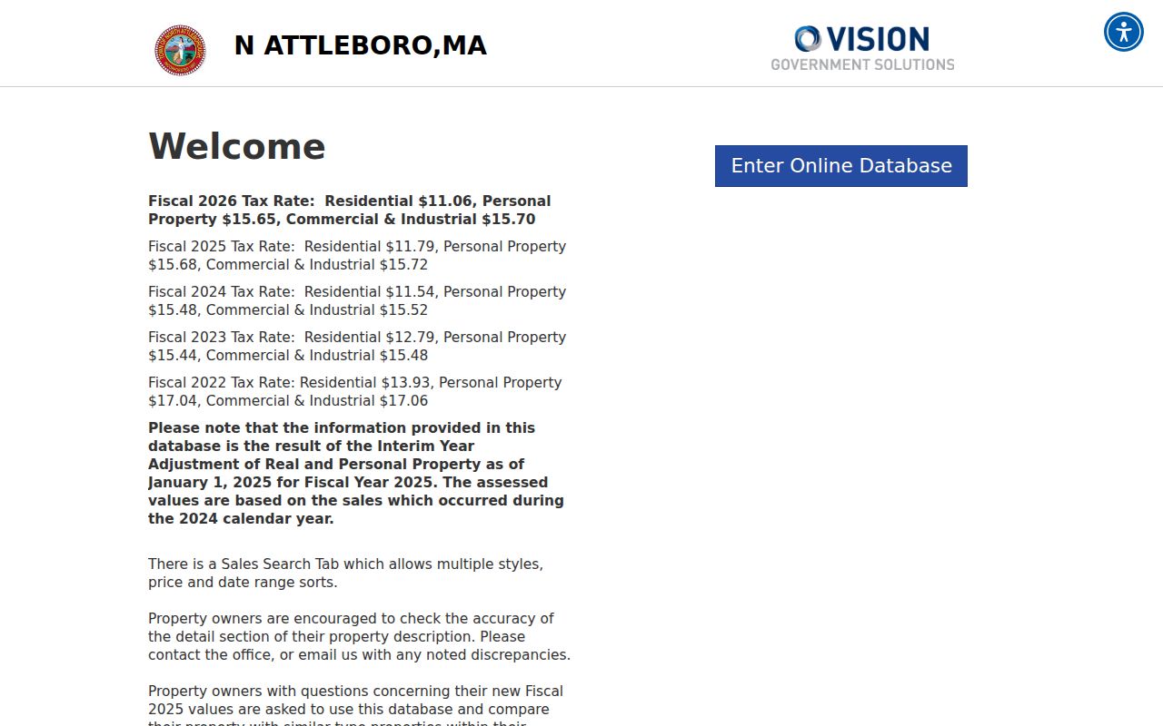
Use the parcel result to separate the physical site from correspondence information before expanding a street-by-street search.
North Attleborough Street MapGeo
MapGeo supplies the geographic part of a North Attleborough street directory search. The observed town URL includes a property dataset, zoning theme, coordinate, zoom level, and an abuttersDistance=300 parameter. That is evidence of a 300-foot abutter-distance setting or layer in the viewer. It does not confirm every distance choice or every detail field visible today. Start from the subject parcel, select adjacent polygons that matter, and note the address and parcel identifier for each.
Map geometry is not a resident list. An adjoining parcel may belong to a trust, organization, government body, vacant lot, or owner who receives mail elsewhere. The useful chain is parcel location, owner-of-record source, recording date, deed citation, and map date. When older context is needed, ask the Assessors office or make a focused request rather than assuming a current layer represents earlier boundaries.
North Attleborough Registry Street Search
The Northern Bristol County Registry Street Inquiry accepts start date, end date, document type, street number, street name, and town. Use North Attleborough for the town, then repeat the search with a former street name when history suggests one. The Registry explicitly warns that older documents may omit street fields. A no-result street query therefore calls for a party search, not a conclusion that no document exists.
The Registry’s Advanced Image Search is another route into land-record images. The Registry distinguishes online index/image viewing from formal public-records requests, so preserve the source and coverage statement for the route used.
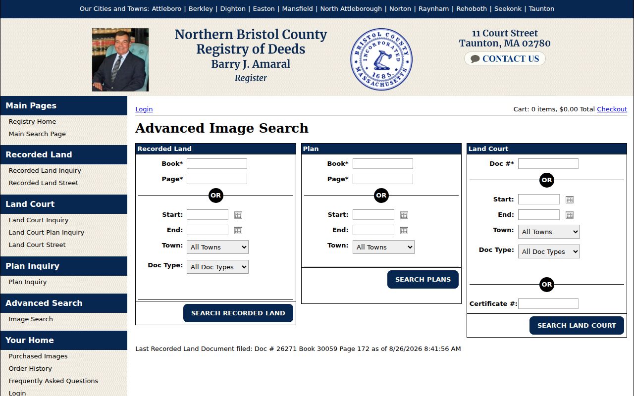
Use an image result to verify the names, dates, document reference, and legal description cited by an index row.
The Recorded Land Inquiry supports the companion party search. Search a current owner as a grantee, open the deed image or citation, identify the grantor, and then search that seller as a prior grantee. Legal descriptions, plans, book/page references, and nearby parcels help keep the sequence tied to the same land.
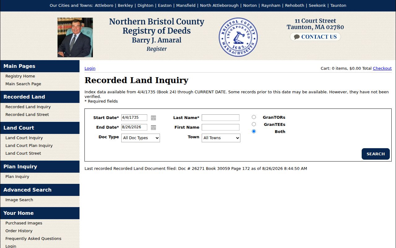
A party chain establishes recorded ownership history, not a complete list of people connected with the address.
The address-specific Recorded Land Street Inquiry stores a different key: the entered street information. Pair it with party variants, especially where trustees, historical spellings, or old street names appear.
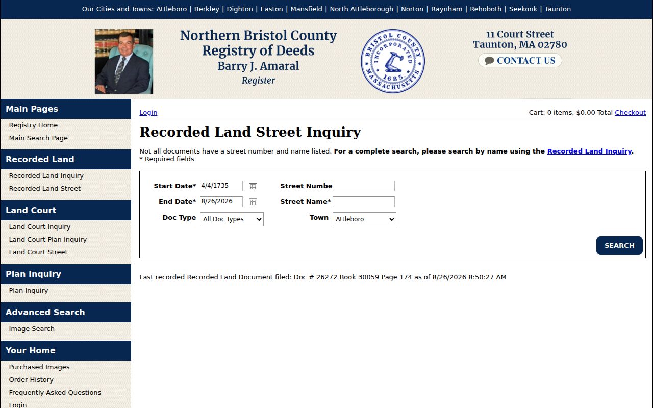
The street inquiry is strongest as one part of the parcel-and-party chain, not as a substitute for it.
Note: The portal displays recorded-land indexed data from April 4, 1735, while separate historic Tor/Tee image books extend to 1686 and the Registry’s public-records page describes other online coverage differently.
North Attleborough Address Record Coverage
Each address-keyed system records a different relationship. The table keeps the North Attleborough street directory focused on evidence that can actually be searched by address, street, parcel, or owner. “Situs” means the physical parcel address. A mailing address is where assessment correspondence goes. They may match, but the records do not require them to match.
| Address-keyed source | What it can show | Search method and limitation |
|---|---|---|
| Vision assessor | Owner, co-owner, situs, mailing address, value, sales, and parcel features | Property/sales portal; exact local labels and parcel format were not confirmed. |
| MapGeo | Parcel polygon, zoning and property layers, map position, nearby parcels | Quick search or map click; observed 300-foot parameter; no confirmed ZIP search. |
| Registry Street Inquiry | Deeds and documents entered with street number/name, town, date, and type | Use date, document type, street, and town; old documents can lack street values. |
| Registry party inquiry | Grantor/grantee chain, book/page, document number, and image | Search name variants and roles; historical spellings and trustees complicate a street-only search. |
| Building permits | Permit number, address, work, published applicant/owner fields, and inspection trail | Monthly files for 2025/2026, with an Archive Center route for 2024 and older records. |
| Voter list or directory | Registration fields where lawfully released, or dated household/address clues | Town request or library collection; no state browse-by-street lookup, and historical directory runs are partial. |
For individual registration verification, the Massachusetts voter search requires first name, last name, date of birth, a five-digit ZIP, and agreement to its terms. It has no public browse-by-street mode. A North Attleborough voter list or Residents’ Listed Book begins with Elections or the Town Clerk, and confidential voter information remains protected.
North Attleborough Street Permit Trail
Building records can place work at an address without turning a permit into a resident record. The Monthly List of Building Permits Issued provides downloadable 2025 and 2026 reports and directs older material to the Archive Center. A permit number can be entered in the town software for detail where available. The town also says that a custom report costs $100 in advance, so request only the address, date range, fields, and format needed.
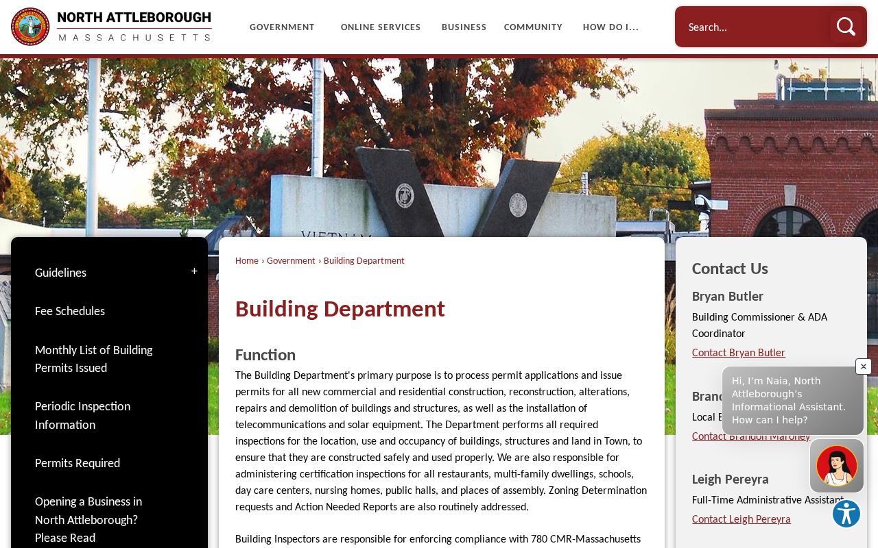
The North Attleborough Building Department provides the entry point for permits, codes, ViewPoint Cloud, kiosk, and paper-submission information.
When a permit report provides a useful date, compare it with the assessment year and recording date rather than assuming all three describe the same event.
For a permit-holder’s inspection workflow, Inspection Requests and Scheduling describes the ViewPoint account path: My Account, Inspections, the record, then Request Inspection. Next-business-day scheduling needs submission one hour before close, and exact inspection times are not promised.
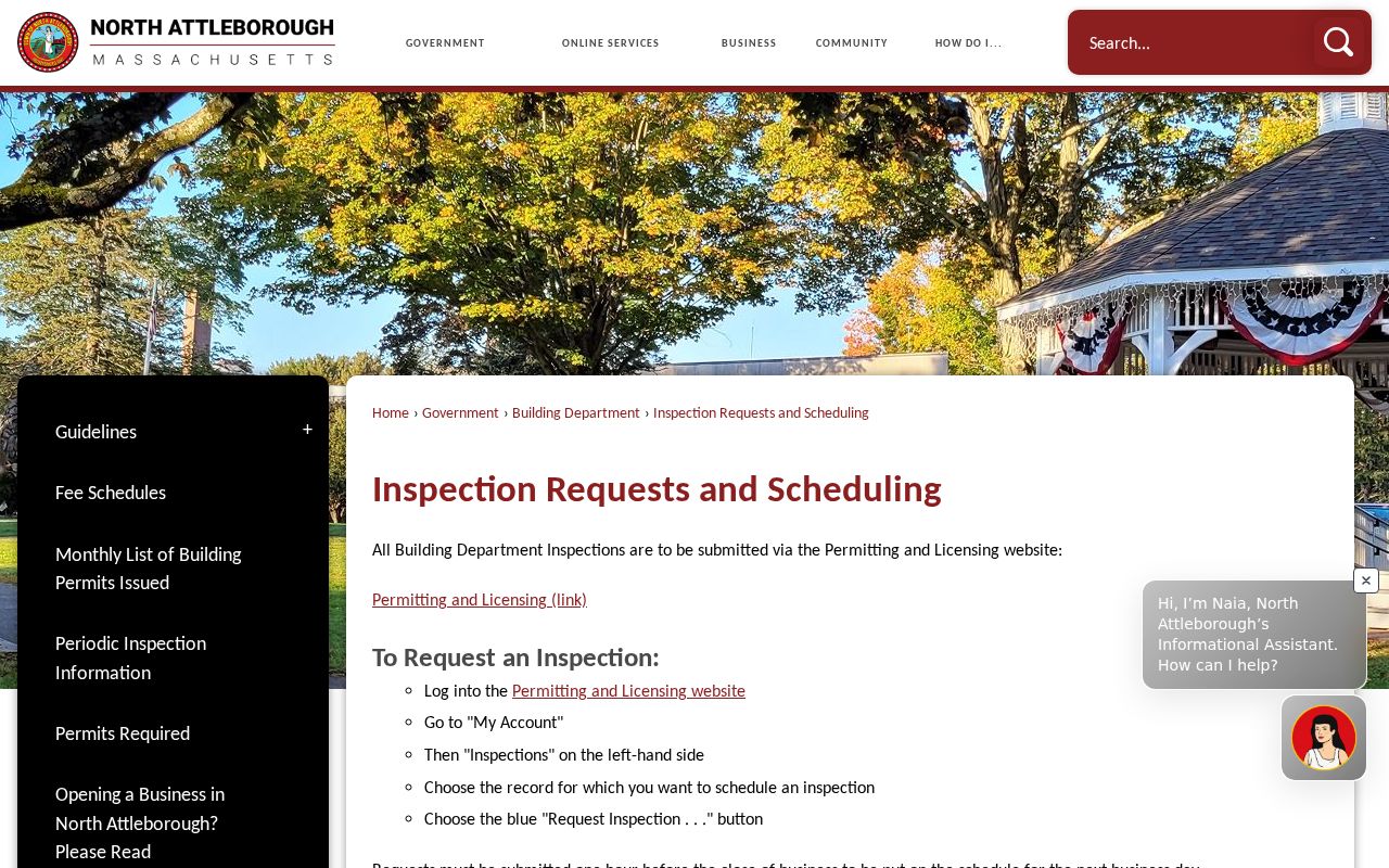
Inspection scheduling describes access for a permit record. It does not open a general street roster or prove who lives at the property.
North Attleborough Street Name Changes
One confirmed North Attleborough address clue is narrow but valuable. The town’s John F. Sturdy House page identifies 110 Towne Street as Elm Street on an 1858 map. That fact supports a two-name search for this address: query Towne Street and Elm Street in deeds, directories, newspapers, permits, and maps, then attach the year to each result.
No official townwide street-renaming or renumbering schedule was located. Do not convert an old house number into a present address by assumption. Compare 1858, 1878, and 1891 map context, consult Sanborn material for later numbering clues, and verify parcel continuity with the assessor, GIS, and deed description. The Sturdy example is a local search clue, not evidence of a townwide renumbering project.
North Attleborough Street Directory Snapshots
For an older street directory entry, Richards Memorial Library is the practical local reference desk. Its local-history collection lists town histories, newspapers, directories, maps, Residents’ Listed Books, and house-history assistance. The library’s annual Persons Listed volumes reach back to 1941, and local newspaper microfilm can place a name or address in a dated notice. These are historical snapshots, not current-address proof.
A criss-cross directory is a reverse directory organized around an address or street rather than a personal name. It can help after a deed or parcel search narrows the block. Exact reverse-directory years, entry format, and completeness were not confirmed. Ask the library which volume covers the date needed, whether it is complete, and whether staff help or a visit is required.
- Parcel
- A defined tract in the assessor or deed system, often tied to an identifier and physical location.
- Situs address
- The physical parcel address, distinct from an owner mailing address when tax mail goes elsewhere.
- Legal description
- The deed or plan description used to keep a title chain on the same land.
- Criss-cross directory
- A historical directory arranged by address or street, useful for dated clues when a matching volume exists.
North Attleborough Street Parcels Nearby
For the immediate area around an address, use MapGeo to select the subject parcel and adjacent polygons, then ask the Assessors office about its online abutter-list route or a formal list request. The observed MapGeo configuration supports an abutter-distance parameter, but current radius choices, list definition, and fee were not confirmed. An abutter list is parcel-based and distance-based. It is not a block-wide resident directory.
Retain only what supports the parcel relationship: subject and adjoining parcel identifiers, situs addresses, map date, owner-of-record source, recording date, and deed citation. Then search selected owners or addresses at the Registry. This approach is more reliable than collecting personal details that do not answer the land question.
North Attleborough Address Request Route
When an address file is not online, send the request to its custodian. Assessment, tax, and abutter material belongs with Assessors at Town Hall, 43 South Washington Street, Upper Level, ext. 2514. Permits and inspections belong with Building. Land documents belong with the Northern Bristol County Registry of Deeds at 11 Court Street, Taunton, MA 02780, 508-822-0502. Historical directories and newspaper material belong with the library. A court matter goes through MassCourts or the appropriate Trial Court clerk, not a town records officer.
Under the Massachusetts Public Records Law, M.G.L. c. 66 §10, a request may be written, emailed, mailed, or made in person. State the address, record series, date range, requested fields, and desired format. A targeted request for permit number, type, status, and final inspection is more workable than a request for every record connected to an address. Ask for a fee estimate where a custom compilation may be needed.
Note: Registry document copies use the Registry’s own document route; a public-records request does not replace a direct search or copy order for a recorded deed.
North Attleborough Street Search Limits
A street directory cannot identify every household member, private utility customer, delivery recipient, or protected voter. A property record is often owner-based. A voter result, when available, is tied to registration and legal access rules. The Massachusetts individual voter search is not a browse tool, and ordinary public voter fields exclude phone, email, confidential-voter information, and other protected information. Massachusetts motor-vehicle address information is also restricted by the Driver’s Privacy Protection Act.
A missing result can reflect a different custodian, a former street name, an older image-only index, or a lawful restriction. It does not establish that a person has no connection to North Attleborough. For an apparent public-record error, preserve the record date and field, then contact the original custodian with a precise correction request.